1 boats and yachts available for charter in Miami
INSTANT BOOKING
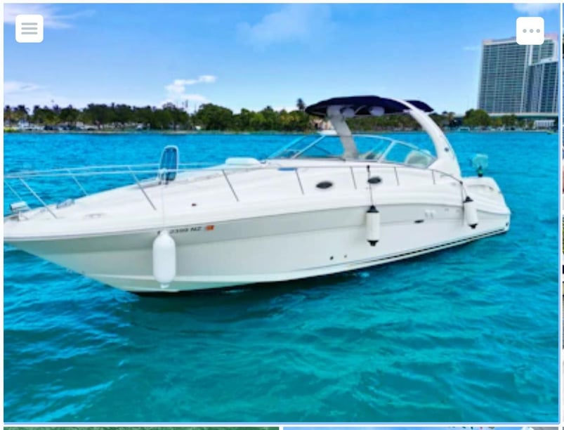
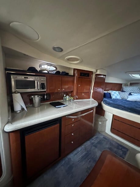
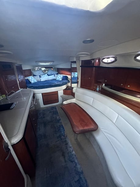
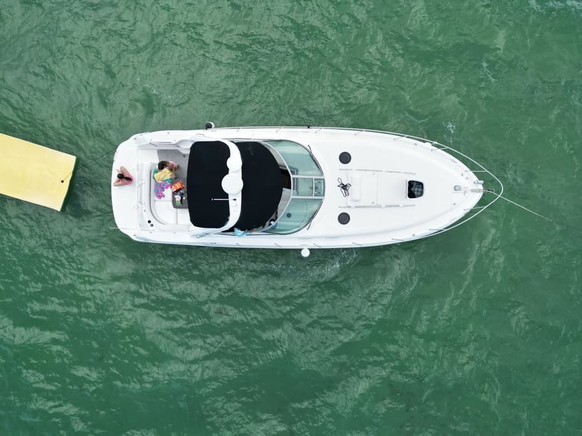
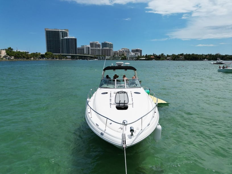
- Sea Ray, 340 Sundancer
- 2007
- Fort Lauderdale - Florida (Miami: 38.3 km away)
- 12 guests
- 11.6 m
- 1 WC
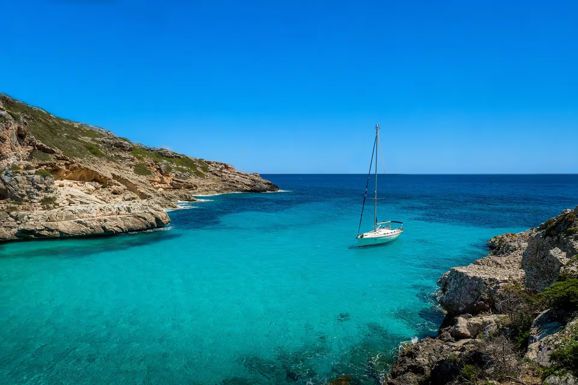
A yacht charter in Miami places Biscayne Bay at the center of the trip. The city occupies the bay’s western shore, while Virginia Key, Key Biscayne and other islands separate much of its protected water from the open Atlantic. This geography allows a cruise to move quickly from Downtown Miami’s skyline to sandbars, mangrove shorelines and the northern Florida Keys.
Miami suits travelers who want to combine time on the water with beaches, waterfront dining and evening life ashore. Its Cuban, Caribbean and wider Latin American influences are particularly visible in the city’s food and culture. Rather than relying on one central embarkation point, yacht trips may begin at marinas distributed around Downtown, Coconut Grove, Virginia Key, Key Biscayne and northern Biscayne Bay.
Central Biscayne Bay offers the most immediate contrast between city and water. Cruising near Downtown and Brickell provides broad skyline views, while Miami Beach and South Beach place the city’s Atlantic-facing beaches and Art Deco district within reach of a shore visit. Coconut Grove combines an established waterfront with access to the bay’s southern reaches.
Virginia Key and Key Biscayne mark the transition from dense urban waterfronts to beaches, parks and more open water. Bill Baggs Cape Florida State Park, at the southern end of Key Biscayne, is home to Cape Florida Light, first erected in 1825.
Farther south, Stiltsville’s structures rise above shallow seagrass flats near the northern waters of Biscayne National Park. Longer outings can continue toward Boca Chita Key, Elliott Key and offshore reef areas. These southern destinations are less urban, but their shallow approaches make route choice, vessel draft and local conditions important considerations.
Biscayne Bay’s generally protected waters support day sailing, motor-yacht outings and relatively short passages between waterfront districts and islands. The shelter should not be confused with uniformly simple navigation, however. Broad shallow banks, sensitive seagrass beds and marked channels require close attention to charts, tides and channel markers.
The Atlantic Intracoastal Waterway crosses the area, and traffic can be heavy near marinas, PortMiami and major inlets. Government Cut provides direct ocean access, but it is busy and leads into more exposed conditions. The Atlantic coast, inlets and offshore reefs can therefore feel quite different from the bay.
Overall boating difficulty is moderate. A protected-bay itinerary may suit travelers seeking shorter cruising stages, while ocean or reef trips require greater attention to forecasts and sea conditions. Passing fronts, thunderstorms and local traffic can all affect the day’s route.
Boating is possible throughout the year, but November through April usually provides the most consistently comfortable conditions. These months are generally drier and less humid, with December through April forming the principal high season. Passing winter cold fronts can still bring strong winds and rougher water, so daily marine forecasts remain important.
May and October are transitional periods. From June through September, stable mornings can still provide usable boating weather, but heat, humidity, heavy showers and thunderstorms make conditions less predictable. Rapid wind changes, lightning and occasional waterspouts are practical concerns.
Atlantic tropical-cyclone season runs from June through November, with climatological activity highest from mid-August through mid-October. Travelers considering these months should pay particular attention to cancellation terms, marina hurricane procedures and changing forecasts.
A short itinerary can remain within northern and central Biscayne Bay, following the Intracoastal Waterway between Miami’s urban waterfront, nearby islands and Miami Beach. This keeps passages relatively compact and allows time for swimming or going ashore.
From central Biscayne Bay, trips can continue toward Stiltsville and the northern part of Biscayne National Park. A longer southern route may connect Boca Chita Key and Elliott Key through marked channels across the bay’s shallow banks. Offshore reef and Maritime Heritage Trail excursions add snorkeling or diving possibilities, subject to suitable sea conditions. Mooring buoys near park reefs provide an alternative to anchoring on coral.
Government Cut or Haulover Inlet can be used for Atlantic access, but an ocean segment introduces more exposure than a bay-based route.
Miami’s defining yacht-charter experience is the rapid shift between urban and natural settings. A cruise can begin among high-rise waterfronts, continue past islands and sandbars, and reach mangrove or coral-reef environments without making the city irrelevant to the trip.
Swimming and scenic cruising work well within a bay-focused outing, while snorkeling and diving become more prominent around Biscayne National Park and offshore reefs. Stiltsville adds a distinctive maritime landmark: its remaining structures reflect a community that began developing over the bay’s shallow waters in the 1930s.
Time ashore can bring a different dimension to the itinerary. Miami Beach offers Atlantic beaches and Art Deco architecture, while Little Havana and Calle Ocho provide a closer look at the Cuban food, music and community history that have shaped modern Miami. Waterfront restaurants and nightlife also make it practical to combine daytime cruising with an evening in the city.
Miami International Airport is the principal air gateway, with Metrorail and road connections to the urban core. Fort Lauderdale-Hollywood International Airport is another option, and rail services connect Miami with Fort Lauderdale and other South Florida cities.
Potential departure areas are spread around the bay. Dinner Key Marina in Coconut Grove, Miamarina at Bayside, Miami Marine Stadium Marina, Crandon Marina, Matheson Hammock Marina and Pelican Harbor Marina all illustrate the geographic range of local waterfront facilities. Southern Biscayne Bay and national-park outings may also use access points near Convoy Point or Deering Estate.
Because marinas are dispersed, confirm the precise embarkation location before arranging accommodation or airport transfers. Road transport or ride services are often the simplest way to reach a specific departure point.
Begin by deciding whether the priority is a short urban-and-bay outing, a full day toward Stiltsville, or a longer route into southern Biscayne Bay and the offshore reefs. That decision affects the suitable vessel, cruising time and importance of ocean capability. Travelers comparing a Miami boat rental with a yacht charter should also distinguish between a brief recreational outing and a trip requiring greater onboard comfort, storage or overnight accommodation.
If vessel style is central to the decision, compare the different trip profiles associated with a sailboat charter in Miami and a Miami motor yacht charter. Regardless of format, ask how vessel draft affects access through shallow areas and whether the planned route remains inside the bay or enters exposed Atlantic water.
Current charts, tide information and marine forecasts matter in every season. Observe slow-speed and minimum-wake zones, avoid anchoring on coral or seagrass, and note that personal watercraft are prohibited within Biscayne National Park. Travelers still comparing regions can explore yacht charters across the United States, while nearby Fort Lauderdale yacht charters provide another South Florida point of comparison.
Find the right private boat rental option for your sailing experience and travel style in Miami.
A professional skipper handles the sailing on a skippered yacht charter, while you relax and enjoy. No sailing experience required.
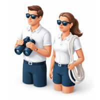
Enjoy ultimate comfort with a private captain and crew on a crewed yacht charter.
Trusted by thousands of travelers booking boat rentals every year.
The best time for yacht charter in Miami depends on the season, with each period offering different sailing conditions and travel experiences.
March, April, December
Peak season
The busiest charter period in Miami falls in March, April, December: 23°C air, 25°C sea, 8 sunny days a month and wind averaging 12 knots.
January, February
Sweet spot
The sweet spot in Miami falls in January, February: 22°C air, 23°C sea, 8 sunny days a month and wind averaging 12 knots with fewer boats out than at peak.
May, June, July, November
Shoulder
Shoulder season in Miami covers May, June, July, November: 27°C air, 29°C sea, 5 sunny days a month and wind averaging 9 knots.
August, September, October
Low season
Low season in Miami covers August, September, October: 28°C air, 30°C sea, 4 sunny days a month and wind averaging 9 knots.
Weather, sea and price values are multi-year climate averages for Miami. The average price shows the seasonal price trend.
| Month | JAN | FEB | MAR | APR | MAY | JUN | JUL | AUG | SEP | OCT | NOV | DEC |
|---|---|---|---|---|---|---|---|---|---|---|---|---|
| 🌡️ Avg. temperature | 21° | 23° | 23° | 25° | 26° | 28° | 29° | 29° | 28° | 27° | 24° | 22° |
| ☀️ Avg. sunny days A day is counted as sunny when average daytime cloud cover is 30% or less. | 7 days | 9 days | 8 days | 9 days | 8 days | 2 days | 4 days | 3 days | 3 days | 6 days | 8 days | 8 days |
| 🌧️ Avg. days with rain A day is counted as rainy when at least 1 mm of rain falls. Monthly rainfall | 8 days53 mm | 6 days37 mm | 6 days39 mm | 9 days56 mm | 14 days120 mm | 22 days199 mm | 23 days138 mm | 24 days180 mm | 22 days211 mm | 17 days132 mm | 10 days79 mm | 8 days65 mm |
| 💨 Avg. wind Shows how windy a typical day is during this month, based on the full-day average. | 12 knSuitable for sailing based on hourly wind data. | 11 knSuitable for sailing based on hourly wind data. | 11 knSuitable for sailing based on hourly wind data. | 11 knSuitable for sailing based on hourly wind data. | 10 knSuitable for sailing based on hourly wind data. | 8 knSuitable for sailing based on hourly wind data. | 7 knSuitable for sailing based on hourly wind data. | 8 knSuitable for sailing based on hourly wind data. | 8 kn | 11 knSuitable for sailing based on hourly wind data. | 11 knSuitable for sailing based on hourly wind data. | 11 knSuitable for sailing based on hourly wind data. |
| 🌊 Avg. seawater temperature | 22° | 24° | 25° | 26° | 29° | 30° | 32° | 32° | 31° | 28° | 26° | 24° |
| 📅 Season | SWEET SPOT | SWEET SPOT | HIGH SEASON | HIGH SEASON | SHOULDER | SHOULDER | SHOULDER | LOW | LOW | LOW | SHOULDER | HIGH SEASON |
Learn everything you need to know about boat rental in Miami, including costs, yacht types, charter options and sailing requirements.
How much does a yacht charter cost in Miami?
What types of boats are available for charter in Miami?
Can I charter a yacht bareboat, with a skipper or with a crew in Miami?
What is the best time for yacht charter in Miami?
What are the popular yacht charter locations near Miami?
How many guests can a yacht charter accommodate in Miami?
What are the most widely available yacht models in Miami?