3 boats and yachts available for charter in United States
INSTANT BOOKING
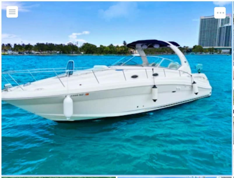
- Sea Ray, 340 Sundancer
- 2007
- Fort Lauderdale - Florida
- 12 guests
- 11.6 m
- 1 WC
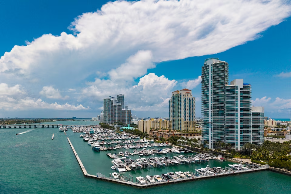
A yacht charter in the United States can mean navigating a warm, shallow passage through the Florida Keys, sailing between New England ports, exploring the freshwater Great Lakes or entering the fjords and island channels of Alaska. The country has Atlantic, Pacific and Gulf coasts, as well as the Great Lakes and the Hawaiian Islands, so there is no single national cruising style.
This variety is the main reason to choose the region before choosing the yacht. Chesapeake Bay and sections of the Intracoastal Waterway offer comparatively protected cruising near coastal towns and working waterfronts. The San Juan Islands combine short island passages with boat-accessible marine parks, while California, Hawaii and parts of Alaska involve more exposed water. A boat rental in the United States may therefore suit anything from relaxed bay exploration to a technically demanding wilderness itinerary, depending on the starting point.
New England combines historic ports, rocky shores and strong maritime traditions. Newport and Boston provide access to Narragansett Bay, Massachusetts Bay and Cape Cod, while Portland, Rockland and Camden lead into the Maine coast and Penobscot Bay. These areas suit travelers interested in sailing culture, coastal history and working harbors, with colder water and a relatively concentrated summer season.
Chesapeake Bay offers a different scale and rhythm. As the largest estuary in the country, it supports protected cruising between Annapolis, Norfolk and smaller waterfront communities. Oysters, blue crabs and the culture of Chesapeake watermen connect time afloat with the region’s working-waterfront identity.
South Florida is centered on Miami, Fort Lauderdale and the Florida Keys. Biscayne Bay and sections of the Intracoastal Waterway provide sheltered options, while Key West and the island chain bring tropical waters, reefs and access toward Dry Tortugas National Park. Shallow depths, coral and seagrass make careful route and anchorage planning especially important.
On the Great Lakes, Chicago offers an urban departure point, while Bayfield leads toward the Apostle Islands. These are freshwater cruising grounds, but their scale, cold water and rapidly changing weather make them more like inland seas than sheltered lakes.
Pacific choices range from San Diego and Southern California’s island routes to San Francisco Bay and the Pacific Northwest. Ventura and Channel Islands Harbor serve the Channel Islands, where open-water crossings contrast with the more protected archipelago cruising of the San Juan Islands. Farther north, Juneau and Seward open the way to Alaska’s fjords, wildlife-rich coast and remote anchorages. Hawaii adds volcanic islands, leeward coastal shelter and exposed inter-island channels.
Conditions vary too widely for a single national difficulty rating. Chesapeake Bay, many Atlantic and Gulf bays, and parts of the Intracoastal Waterway can provide relatively protected passages. Bridges, locks, shoaling and local channel conditions still influence route planning along the waterway.
The Florida Keys are warm but frequently shallow, requiring attention to changing depths, reefs and seagrass. California brings Pacific swell, seasonal coastal fog and persistent northwest winds; waters south of Point Arguello are generally calmer than those farther north. Crossings to the Channel Islands remain exposed and can be affected by fog, shipping traffic and rapidly changing winds.
In Puget Sound and the San Juan Islands, islands create shelter but also funnel strong tidal currents through narrow passes. Southeast Alaska has similarly protected-looking passages, yet large tidal ranges, cold water, fog and localized winds add complexity. Hawaii usually experiences northeast trade winds, with calmer conditions along leeward coasts and greater exposure in open channels. The Great Lakes can produce fog, thunderstorms, sudden squalls and steep conditions despite being freshwater.
Timing should be chosen region by region. New England, the Great Lakes, the Pacific Northwest and Alaska have their principal recreational season from late spring into early autumn. Alaska and other colder areas generally have the shortest practical windows, while winter ice substantially limits ordinary recreational navigation on parts of the Great Lakes and in northern Alaska.
Southern California, Florida and Hawaii support boating through much or all of the year, although year-round access does not mean uniform conditions. Broad country-level seasonality places December through April in the main period, May through July and November in transitional periods, and August through October in a quieter phase. This pattern should not replace local planning: summer remains central to northern cruising regions.
Atlantic and Gulf itineraries require tropical-weather contingency planning during the official Atlantic hurricane season from June 1 through November 30. Hawaii also requires attention to the central Pacific tropical-weather season beginning June 1. No individual months are identified as nationally preferable, so local weather, water temperature and route exposure are more useful than selecting dates from a country-wide calendar.
The Atlantic Intracoastal Waterway creates an extensively protected coastal route from Norfolk through the southeastern states and Florida, with connections toward Miami and the Keys. It suits longer, progressive itineraries, although bridge clearances, locks, shoaling and current channel information affect planning.
The Great Loop is a much larger undertaking linking Atlantic and Gulf intracoastal passages, inland rivers, the Great Lakes, the Hudson River, the Erie Canal and Canadian waterways. Draft, bridge clearance, seasonal weather and border procedures are fundamental considerations rather than minor details.
In the Pacific Northwest, San Juan Islands trips commonly begin at Anacortes or Friday Harbor and combine anchorages, harbor towns and marine parks. The Inside Passage extends the protected-channel concept north through British Columbia and Southeast Alaska, connecting ports such as Ketchikan, Petersburg, Juneau and Sitka with wilderness side trips. By contrast, itineraries from Ventura or Channel Islands Harbor involve open-water crossings to islands without all-weather anchorages.
A United States yacht charter can combine cruising with beaches, swimming, wildlife watching, fishing and visits to historic waterfronts, but the balance changes with the region. Florida emphasizes warm-water boating, island stops and reef environments. The San Juan Islands and Alaska place more emphasis on sheltered passages, wildlife and marine parks, while New England and Chesapeake Bay bring maritime history and food traditions into the trip.
Protected areas are among the country’s distinctive boating experiences. Possible settings include Acadia National Park, the Florida Keys National Marine Sanctuary, Dry Tortugas National Park, the Apostle Islands National Lakeshore, Channel Islands National Park, Glacier Bay and Kenai Fjords. Access and permitted activities differ, so the yacht experience may range from anchoring near an island landscape to going ashore where landings are allowed.
Regional culture also gives each itinerary a different character. Maine’s traditionally rigged windjammers recall the schooner heritage of New England. Chesapeake oysters and blue crabs remain associated with working waterfronts. In Hawaii, Native Hawaiian voyaging culture reflects a much older Pacific tradition of navigation using stars, winds, swells and other environmental signs.
Most major charter regions in the contiguous states are accessible through large coastal airports and road networks. Boston Logan serves the New England coast; Baltimore/Washington International provides access to the Chesapeake region; and Miami and Fort Lauderdale airports serve South Florida. Chicago O’Hare connects with Great Lakes departures from Chicago.
On the Pacific coast, San Diego, Los Angeles, San Francisco and Seattle-Tacoma airports support access to Southern California, San Francisco Bay and the Pacific Northwest. Common starting points include San Diego, Ventura Harbor, Channel Islands Harbor, San Francisco, Seattle, Anacortes and Friday Harbor. Ferries also form an important part of regional access in the San Juan Islands.
Juneau and Seward are principal Alaska departure points, with Juneau International and Ted Stevens Anchorage among the relevant airports. In Hawaii, trips commonly begin around Honolulu or Kailua-Kona, reached through island airports and inter-island flights. Annapolis City Dock, Friday Harbor Marina and Ala Wai Small Boat Harbor are notable waterfront facilities, but the appropriate base ultimately depends on the intended cruising area.
Begin by matching the cruising region to the group’s priorities and experience. Protected estuaries and bays may suit travelers seeking shorter passages and frequent time ashore. Open Pacific crossings, strong tidal channels and remote Alaska itineraries require closer consideration of weather exposure, local knowledge and whether the group’s experience is appropriate for the route. If not, consider arranging a professional skipper where suitable.
Boat characteristics should follow the operating area. Shallow draft matters on parts of the Intracoastal Waterway and in the Florida Keys, while cold-water regions call for appropriate protection even in summer. For island passages, consider the yacht’s suitability for exposed conditions rather than selecting solely by accommodation or deck space.
Before departure, consult current charts, marine forecasts, tide and current predictions, and local notices to mariners. Federal equipment and navigation requirements apply nationally, but registration, operator education, fishing licenses and other rules vary by state. National parks, marine sanctuaries and wildlife areas can also impose local restrictions on anchoring, landing, fishing, sewage discharge, personal watercraft and wildlife approach distances. Checking these details for the exact itinerary is essential because yacht charter conditions in the United States differ far more by region than the national label suggests.
Find the right private boat rental option for your sailing experience and travel style in United States.
A professional skipper handles the sailing on a skippered yacht charter, while you relax and enjoy. No sailing experience required.

Captain the yacht yourself for total freedom on a bareboat yacht charter. A valid sailing license is required.
Enjoy ultimate comfort with a private captain and crew on a crewed yacht charter.
Trusted by thousands of travelers booking boat rentals every year.
The best time for yacht charter in United States depends on the season, with each period offering different sailing conditions and travel experiences.
January, February, December
Peak season
The busiest charter period in United States falls in January, February, December: 22°C air, 25°C sea, 8 sunny days a month and wind averaging 11 knots.
March, April
Sweet spot
The sweet spot in United States falls in March, April: 24°C air, 26°C sea, 8 sunny days a month and wind averaging 11 knots with fewer boats out than at peak.
May, June, July, November
Shoulder
Shoulder season in United States covers May, June, July, November: 27°C air, 29°C sea, 5 sunny days a month and wind averaging 9 knots.
August, September, October
Low season
Low season in United States covers August, September, October: 28°C air, 30°C sea, 4 sunny days a month and wind averaging 9 knots.
Weather, sea and price data are averaged across Fort Lauderdale - Florida, Miami Beach, and Miami. Average prices reflect seasonal pricing trends. For location-specific conditions: Fort Lauderdale - Florida, Miami Beach, and Miami.
| Month | JAN | FEB | MAR | APR | MAY | JUN | JUL | AUG | SEP | OCT | NOV | DEC |
|---|---|---|---|---|---|---|---|---|---|---|---|---|
| 🌡️ Avg. temperature | 21° | 22° | 23° | 25° | 26° | 28° | 28° | 28° | 28° | 26° | 24° | 22° |
| ☀️ Avg. sunny days A day is counted as sunny when average daytime cloud cover is 30% or less. | 7 days | 8 days | 7 days | 9 days | 7 days | 2 days | 4 days | 3 days | 3 days | 6 days | 7 days | 8 days |
| 🌧️ Avg. days with rain A day is counted as rainy when at least 1 mm of rain falls. Monthly rainfall | 8 days55 mm | 6 days38 mm | 6 days41 mm | 10 days60 mm | 14 days123 mm | 22 days205 mm | 23 days143 mm | 25 days183 mm | 23 days214 mm | 18 days135 mm | 11 days81 mm | 8 days64 mm |
| 💨 Avg. wind Shows how windy a typical day is during this month, based on the full-day average. | 11 knSuitable for sailing based on hourly wind data. | 10 knSuitable for sailing based on hourly wind data. | 11 knSuitable for sailing based on hourly wind data. | 10 knSuitable for sailing based on hourly wind data. | 9 knSuitable for sailing based on hourly wind data. | 8 knSuitable for sailing based on hourly wind data. | 7 knSuitable for sailing based on hourly wind data. | 8 knSuitable for sailing based on hourly wind data. | 8 kn | 10 knSuitable for sailing based on hourly wind data. | 10 knSuitable for sailing based on hourly wind data. | 11 knSuitable for sailing based on hourly wind data. |
| 🌊 Avg. seawater temperature | 25° | 25° | 25° | 26° | 28° | 29° | 31° | 31° | 31° | 29° | 28° | 26° |
| 📅 Season | HIGH SEASON | HIGH SEASON | SWEET SPOT | SWEET SPOT | SHOULDER | SHOULDER | SHOULDER | LOW | LOW | LOW | SHOULDER | HIGH SEASON |
Available only for day charters.
Prices vary by yacht type, size, season and charter type. Additional costs such as fuel, skipper fees and security deposit may apply.
Last updated at October 18, 2026
/ day
motor yacht available
€1,707
€1,707
Prices vary by yacht type, size, season and charter type. Additional costs such as fuel, skipper fees and security deposit may apply.
Last updated at October 18, 2026
Learn everything you need to know about boat rental in United States, including costs, yacht types, charter options and sailing requirements.
How much does a yacht charter cost in United States?
What types of boats are available for charter in United States?
Can I charter a yacht bareboat, with a skipper or with a crew in United States?
What is the best time for yacht charter in United States?
What are the popular yacht charter destinations in United States?
How many guests can a yacht charter accommodate in United States?
What are the most widely available yacht models in United States?
Crewed
3 yachts
Skippered
2 yachts
Bareboat
1 yacht